Northwest Snow 2008

All About How You Home Away From Home.

Moderators: Sluggo, Amskeptic

User avatar
DjEep
IAC Addict!
Location: Nowhere, Fast
Status: Offline

Post by DjEep » Wed Apr 23, 2008 3:11 pm

The "warm pool" was probably about 102*, so the pools weren't clammy.

The fun part was the half-naked barefoot 100m dash to the bathrooms through snow, slush and mud.

That and when the misses fell into the creek while washing the dishes :blackeye: (which is why I am seen washing the rest of the dishes).

With all the sogginess, it took a while to get the fire going well, including moving the burning fire three feet to the left to stop the smoke from filling the bus, but by ~9:30pm I couldn't stand closer than 4-5' to it.
"Live life, love life. Enjoy the pleasures and the sorrows. For it is the bleak valleys, the dark corners that make the peaks all the more magnificent. And once you realize that, you begin to see the beauty hidden within those valleys, and learn to love the climb." - Anonymous

Do you want to Survive? Or do you want to LIVE?

User avatar
Gypsie
rusty aircooled mekanich
Location: Treadin' Lightly under the Clear Blue!
Status: Offline

Post by Gypsie » Wed Apr 23, 2008 5:48 pm

hambone wrote:I like nudies.
good to know ;-)

DJ: looks like a great trip.

Glasseye: Jealous!
So it all started when I wanted to get better gas mileage....

User avatar
glasseye
IAC Addict!
Location: Kootenays, BC
Status: Offline

Post by glasseye » Wed Apr 23, 2008 5:58 pm

hambone wrote:Nice pics! That looks chill-to-the-bone clammy.
Totally sit-outside-the-bus-by-the-fire weather. Great images. Our friends from the desert will be looking at those in a few months, wishing they were there.
"This war will pay for itself."
Paul Wolfowitz, speaking of Iraq.

User avatar
DjEep
IAC Addict!
Location: Nowhere, Fast
Status: Offline

Post by DjEep » Wed Apr 23, 2008 7:55 pm

glasseye wrote:
hambone wrote:Nice pics! That looks chill-to-the-bone clammy.
Totally sit-outside-the-bus-by-the-fire weather.
My favorite kind. Give me a cold night and a hot fire over hot sun any time. There is something to be said for hearing the fire crackling outside and the rain pattering on the roof while cozy in the bus with someone special.

And I love the the misty, moisty forest. It gives off an ancient aura of life that can't really be explained better than that.
"Live life, love life. Enjoy the pleasures and the sorrows. For it is the bleak valleys, the dark corners that make the peaks all the more magnificent. And once you realize that, you begin to see the beauty hidden within those valleys, and learn to love the climb." - Anonymous

Do you want to Survive? Or do you want to LIVE?

User avatar
DjEep
IAC Addict!
Location: Nowhere, Fast
Status: Offline

Post by DjEep » Sun Apr 27, 2008 10:56 am

Got some more snowy pics from our 4/20 trip to McCredie Springs. Note the eyelid level on Boobs and I in the second picture. 4/20 at a hot spring will do that to you...

Image

Image

Image
"Live life, love life. Enjoy the pleasures and the sorrows. For it is the bleak valleys, the dark corners that make the peaks all the more magnificent. And once you realize that, you begin to see the beauty hidden within those valleys, and learn to love the climb." - Anonymous

Do you want to Survive? Or do you want to LIVE?

User avatar
hambone
Post-Industrial Non-Secular Mennonite
Location: Portland, Ore.
Status: Offline

Post by hambone » Mon Apr 28, 2008 10:25 am

...ANOTHER ROUND OF SNOW COMING TO THE MOUNTAINS OF SOUTHWEST
WASHINGTON AND NORTHWEST OREGON DURING THE FIRST HALF OF THIS
WEEK..

COLD SPRING WEATHER IS TAKING HOLD OVER SOUTHWEST WASHINGTON AND
NORTHWEST OREGON AGAIN DURING THE FIRST HALF OF THIS WEEK.

ANOTHER RATHER COLD SYSTEM IN THE EASTERN PACIFIC WILL LOWER SNOW
LEVELS TO BELOW CASCADE PASS ELEVATIONS TONIGHT...THEN DOWN TO
AROUND 2000 FEET TUESDAY AND WEDNESDAY.

SNOW ACCUMULATIONS IN THE CASCADES COULD REACH 6 TO 12 INCHES
BEGINNING LATE TONIGHT AND CONTINUING TUESDAY THROUGH WEDNESDAY.

SNOW ACCUMULATIONS ABOVE ABOUT 2000 FEET IN THE COASTAL
MOUNTAINS...THE CASCADE FOOTHILLS...AND THE UPPER HOOD RIVER
VALLEY COULD REACH A COUPLE OF INCHES AS WELL.

IF YOU ARE PLANNING TRAVEL THROUGH THE MOUNTAINS OF SOUTHWEST
WASHINGTON AND NORTHWEST OREGON DURING THE FIRST HALF OF THE
WEEK...BE PREPARED FOR WINTER LIKE DRIVING CONDITIONS AGAIN.

$$
http://greencascadia.blogspot.com
http://pdxvolksfolks.blogspot.com
it balances on your head just like a mattress balances on a bottle of wine
your brand new leopard skin pillbox hat

User avatar
spiffy
IAC Addict!
Location: Walla Walla, WA
Status: Offline

Post by spiffy » Mon Apr 28, 2008 11:11 am

Jeesh. Good for the glaciers up there though, hopefully they gain a few inches of ice back.

Going to be a SHORT season in the uber high country, betcha some of the roads wont even get dug out before next winter hits....unless we have a really toasty summer.
78 Riviera "Spiffy"
67 Riviera "Bill"

User avatar
hambone
Post-Industrial Non-Secular Mennonite
Location: Portland, Ore.
Status: Offline

Post by hambone » Mon Apr 28, 2008 12:22 pm

La Niña has been blamed:
http://www.elnino.noaa.gov/lanina.html

What is La Niña?
La Niña is defined as cooler than normal sea-surface temperatures in the central and eastern tropical Pacific ocean that impact global weather patterns. La Niña conditions recur every few years and can persist for as long as two years.

What is the difference between La Niña and El Niño?
El Niño and La Niña are extreme phases of a naturally occurring climate cycle referred to as El Niño/Southern Oscillation. Both terms refer to large-scale changes in sea-surface temperature across the eastern tropical Pacific. Usually, sea-surface readings off South America's west coast range from the 60s to 70s F, while they exceed 80 degrees F in the "warm pool" located in the central and western Pacific. This warm pool expands to cover the tropics during El Niño, but during La Niña, the easterly trade winds strengthen and cold upwelling along the equator and the West coast of South America intensifies. Sea-surface temperatures along the equator can fall as much as 7 degrees F below normal.

Why do El Niño and La Niña occur?
El Niño and La Niña result from interaction between the surface of the ocean and the atmosphere in the tropical Pacific. Changes in the ocean impact the atmosphere and climate patterns around the globe. In turn, changes in the atmosphere impact the ocean temperatures and currents. The system oscillates between warm (El Niño) to neutral (or cold La Niña) conditions with an on average every 3-4 years.

What causes La Niña?*
Typically, a La Niña is preceded by a buildup of cooler-than-normal subsurface waters in the tropical Pacific. Eastward-moving atmospheric and oceanic waves help bring the cold water to the surface through a complex series of events still being studied. In time, the easterly trade winds strengthen, cold upwelling off Peru and Ecuador intensifies, and sea-surface temperatures (SSTs) drop below normal. During the 1988- 89 La Niña, SSTs fell to as much as 4 degrees C (7 degrees F) below normal. Both La Niña and El Niñq tend to peak during the Northern Hemisphere winter.

What's the difference between La Niña and El Niño?*
Both terms refer to large-scale changes in sea-surface temperature across the central and eastern tropical Pacific. Usually, sea-surface readings off South America's west coast range from the 60s to 70s F, while they exceed 80 degrees F in the "warm pool" located in the central and western Pacific. This warm pool expands to cover the tropics during El Niño but shrinks to the west during La Niña. The El Niño/Southern Oscillation (ENSO) is the coupled ocean-atmosphere process that includes both El Niño and La Niña.

What are the global impacts of La Niña?
Both El Niño and La Niña impact global and U.S. climate patterns. In many locations, especially in the tropics, La Niña (or cold episodes) produces the opposite climate variations from El Niño. For instance, parts of Australia and Indonesia are prone to drought during El Niño, but are typically wetter than normal during La Niña.

What are the U.S. impacts of La Niña?
La Niña often features drier than normal conditions in the Southwest in late summer through the subsequent winter. Drier than normal conditions also typically occur in the Central Plains in the fall and in the Southeast in the winter. In contrast, the Pacific Northwest is more likely to be wetter than normal in the late fall and early winter with the presence of a well-established La Niña. Additionally, on average La Niña winters are warmer than normal in the Southeast and colder than normal in the Northwest.

Does a La Niña typically follow an El Niño?
No, a La Niña episode may, but does not always follow an El Niño.

Is there such a thing as "normal", aside from El Niño and La Niña?*
Over the long-term record, sea-surface temperatures in the central and eastern tropical Pacific diverge from normal in a roughly bell-curve fashion, with El Niño and La Niña at the tails of the curve. Some researchers argue there are only two states, El Niño and non-El Niño, while others believe either El Niño or La Niña is always present to a greater or lesser degree. According to one expert, NCAR's Kevin Trenberth, El Niños were present 31% of the time and La Niñas 23% of the time from 1950 to 1997, leaving about 46% of the period in a neutral state. The frequency of El Niños has increased in recent decades, a shift being studied for its possible relationship to global climate change.

How often does La Niña occur?
El Niño and La Niña occur on average every 3 to 5 years. However, in the historical record the interval between events has varied from 2 to 7 years. According to the National Centers for Environmental Prediction, this century's previous La Niñas began in 1903, 1906, 1909, 1916, 1924, 1928, 1938, 1950, 1954, 1964, 1970, 1973, 1975, 1988, and 1995. These events typically continued into the following spring. Since 1975, La Niñas have been only half as frequent as El Niños.

How long does a La Niña last?
La Niña conditions typically last approximately 9-12 months. Some episodes may persist for as long as two years.

How do scientists detect La Niña and El Niño and predict their evolution?
Scientists from NOAA and other agencies use a variety of tools and techniques to monitor and forecast changes in the Pacific Ocean and the impact of those changes on global weather patterns. In the tropical Pacific Ocean, El Niño is detected by many methods, including satellites, moored buoys, drifting buoys, sea level analysis, and expendable buoys. Many of these ocean observing systems were part of the Tropical Ocean Global Atmosphere (TOGA) program, and are now evolving into an operational El Niño/Southern Oscillation (ENSO) observing system.
NOAA also operates a research ship, the KA'IMIMOANA, which is dedicated to servicing the Tropical Ocean Atmosphere (TAO) buoy network component of the observing system. Large computer models of the global ocean and atmosphere, such as those at the National Centers for Environmental Prediction, use data from the ENSO observing system as input to predict El Niño. Other models are used for El Niño research, such as those at NOAA's Geophysical Fluid Dynamics Laboratory, at the Center for Ocean-Land-Atmosphere Studies, and other research institutions.

Why is predicting these types of events so important?
Better predictions of the potential for extreme climate episodes like floods and droughts could save the United States billions of dollars in damage costs. Predicting the onset of a warm or cold phase is critical in helping water, energy and transportation managers, and farmers plan for, avoid or mitigate potential losses. Advances in improved climate predictions will also result in significantly enhanced economic opportunities, particularly for the national agriculture, fishing, forestry and energy sectors, as well as social benefits.

What is the relationship between El Niño/La Niña and global warming?
The jury is still out on this. Are we likely to see more El Niños because of global warming? Will they be more intense? These are the main research questions facing the science community today. Research will help us separate the natural climate variability from any trends due to man's activities. We cannot figure out the "fingerprint" of global warming if we cannot sort out what the natural variability does. We also need to look at the link between decadal changes in natural variability and global warming. At this time we can't preclude the possibility of links but it would be too early to definitely say there is a link.
It is inaccurate to label individual storms or events as a La Niña or El Niño event. Rather, these climate extremes affect the position and intensity of the jet streams, which in turn affect the intensity and track of storms. During La Niña, the normal climate patterns are enhanced. For example, in areas that would normally experience a wet winter, conditions would likely be wetter than normal.

How is La Niña influencing the Atlantic and Pacific hurricane seasons?
Dr. William Gray at the Colorado State University has pioneered research efforts leading to the discovery of La Niña impacts on Atlantic hurricane activity, and to the first and, presently only, operational long-range forecasts of Atlantic basin hurricane activity. According to this research, the chances for the continental U.S. and the Caribbean Islands to experience hurricane activity increases substantially during La Niña.

What impacts do El Niño and La Niña have on tornadic activity across the country?
Since a strong jet stream is an important ingredient for severe weather, the position of the jet stream determines the regions more likely to experience tornadoes.
Contrasting El Niño and La Niña winters, the jet stream over the United States is considerably different. During El Niño the jet stream is oriented from west to east over the northern Gulf of Mexico and northern Florida. Thus this region is most susceptible to severe weather. During La Niña the jet stream extends from the central Rockies east- northeastward to the eastern Great Lakes. Thus severe weather is likely to be further north and west during La Niña than El Niño.

Why has the public not heard much about La Niña before now?*
For many decades, scientists have known about the oscillation in atmospheric pressure across the tropical Pacific at the heart of both El Niño and La Niña. However, La Niña's effects on fisheries along the immediate coast of South America, where El Niño was named, are benign rather than destructive, so La Niña received relatively little attention there. Research on La Niña increased after its wider impacts (often called teleconnections) were recognized in the 1980s.
http://greencascadia.blogspot.com
http://pdxvolksfolks.blogspot.com
it balances on your head just like a mattress balances on a bottle of wine
your brand new leopard skin pillbox hat

User avatar
Ritter
IAC Addict!
Location: Sonoma County, CA
Status: Offline

Post by Ritter » Mon Apr 28, 2008 1:23 pm

Man, we sure could use some of your wet weather here in northern California. We've got another year of below average rainfall....

If you care for vicarious living, it was 90* here this weekend. Made for some sweaty labor finishing up the garden boxes and filling them with top soil!
1978 Westfalia 2.0 FI

User avatar
hambone
Post-Industrial Non-Secular Mennonite
Location: Portland, Ore.
Status: Offline

Post by hambone » Mon Apr 28, 2008 1:38 pm

Damn...that's too hot! Especially in April.
I'm a salamander, I love the chilly damp. But extremes do suck.
http://greencascadia.blogspot.com
http://pdxvolksfolks.blogspot.com
it balances on your head just like a mattress balances on a bottle of wine
your brand new leopard skin pillbox hat

User avatar
Ritter
IAC Addict!
Location: Sonoma County, CA
Status: Offline

Post by Ritter » Mon Apr 28, 2008 1:54 pm

hambone wrote:Damn...that's too hot! Especially in April.
Yeah, we keep getting these weird waves of a few days way above average followed by days of below average. We should be in the low 70s right now. No rain to speak of since the end of January. :pale:
1978 Westfalia 2.0 FI

User avatar
hambone
Post-Industrial Non-Secular Mennonite
Location: Portland, Ore.
Status: Offline

Post by hambone » Wed Apr 30, 2008 1:12 pm

SPECIAL WEATHER STATEMENT
NATIONAL WEATHER SERVICE PORTLAND OR
1212 PM PDT WED APR 30 2008

ORZ007-010315-
CENTRAL WILLAMETTE VALLEY-
INCLUDING THE CITIES OF...SALEM...MCMINNVILLE...DALLAS
1212 PM PDT WED APR 30 2008

...FUNNEL CLOUD REPORTED NEAR SALEM IN MARION COUNTY...

AT 1154 AM PDT A PILOT REPORTED A FUNNEL CLOUD 10 MILES WEST OF
SALEM IN MARION COUNTY AND IT QUICKLY DISSIPATED. THE AIR MASS IS
UNSTABLE AND IT IS NOT UNCOMMON FOR THESE TYPES OF FUNNELS TO FORM
IN THIS WEATHER PATTERN. IT IS MUCH LESS LIKELY FOR ONE TO TOUCH
DOWN ON THE GROUND. IF THEY DO HOWEVER THEY CAN CAUSE DAMAGE.
http://greencascadia.blogspot.com
http://pdxvolksfolks.blogspot.com
it balances on your head just like a mattress balances on a bottle of wine
your brand new leopard skin pillbox hat

User avatar
Emily's Owner
Old School!
Location: Canby, Oregon
Status: Offline

Post by Emily's Owner » Wed Apr 30, 2008 9:10 pm

It snowed up in the Blues overnight (again and again and again...) - they shut down Cabbage Hill on I-84 for a while today it was so slippery. With the wind whipping down out of the mountains it's been damn chilly here. The orchards are very concerned over Milton-Freewater way, and the wheat farmers are also worried as wheat is at half the height it should be right now.
Margaret


Lead me not into temptation...... Oh hell, who are we kidding, follow me, I know a shortcut.

User avatar
Ritter
IAC Addict!
Location: Sonoma County, CA
Status: Offline

Post by Ritter » Thu May 01, 2008 8:08 am

It's official. We just had the driest March-April on record. It's gonna be fun times this summer.... :pale:
1978 Westfalia 2.0 FI

User avatar
hambone
Post-Industrial Non-Secular Mennonite
Location: Portland, Ore.
Status: Offline

Post by hambone » Wed May 14, 2008 12:54 pm

--------------------------------------------------------------------------------

Special Weather Statement

--------------------------------------------------------------------------------

SPECIAL WEATHER STATEMENT
NATIONAL WEATHER SERVICE PORTLAND OR
1020 AM PDT WED MAY 14 2008

ORZ001>014-WAZ019>023-039-040-152200-
NORTH OREGON COAST-CENTRAL OREGON COAST-
COAST RANGE OF NORTHWEST OREGON-
CENTRAL COAST RANGE OF WESTERN OREGON-LOWER COLUMBIA-
GREATER PORTLAND METRO AREA-CENTRAL WILLAMETTE VALLEY-
SOUTH WILLAMETTE VALLEY-WESTERN COLUMBIA RIVER GORGE-
NORTHERN OREGON CASCADE FOOTHILLS-NORTHERN OREGON CASCADES-
CASCADE FOOTHILLS IN LANE COUNTY-CASCADES IN LANE COUNTY-
UPPER HOOD RIVER VALLEY-SOUTH WASHINGTON CASCADES-WILLAPA HILLS-
SOUTH WASHINGTON COAST-I-5 CORRIDOR IN COWLITZ COUNTY-
GREATER VANCOUVER AREA-SOUTH WASHINGTON CASCADE FOOTHILLS-
INCLUDING THE CITIES OF...ASTORIA...CANNON BEACH...TILLAMOOK...
LINCOLN CITY...NEWPORT...FLORENCE...VERNONIA...JEWELL...TRASK...
GRANDE RONDE...TIDEWATER...SWISSHOME...ST. HELENS...CLATSKANIE...
HILLSBORO...PORTLAND...OREGON CITY...GRESHAM...SALEM...
MCMINNVILLE...DALLAS...EUGENE...CORVALLIS...ALBANY...HOOD RIVER...
CASCADE LOCKS...MULTNOMAH FALLS...SANDY...
SILVER FALLS STATE PARK...SWEET HOME...GOVERNMENT CAMP...
DETROIT...SANTIAM PASS...VIDA...LOWELL...COTTAGE GROVE...
MCKENZIE BRIDGE...OAKRIDGE...WILLAMETTE PASS...PARKDALE...ODELL...
COLDWATER RIDGE VISITORS CENTER...MOUNT ST. HELENS...FRANCES...
RYDERWOOD...RAYMOND...LONG BEACH...CATHLAMET...LONGVIEW...KELSO...
CASTLE ROCK...STEVENSON...SKAMANIA...VANCOUVER...BATTLE GROUND...
WASHOUGAL...TOUTLE...ARIEL...COUGAR
1020 AM PDT WED MAY 14 2008

...UNSEASONABLY HOT WEATHER WILL BURST INTO SOUTHWEST WASHINGTON
AND NORTHWEST OREGON THURSDAY THROUGH MUCH OF THE WEEKEND...

AFTER A VERY PROLONGED PERIOD OF ABNORMALLY COOL SPRING WEATHER
...THE HOTTEST WEATHER OF THE YEAR...MORE LIKE MID SUMMER...WILL
BURST INTO SOUTHWEST WASHINGTON AND NORTHWEST OREGON THURSDAY...
THEN CONTINUE OVER THE REGION INTO THE WEEKEND.

THIS WILL BE THE HOTTEST WEATHER SINCE LAST SEPTEMBER.

TEMPERATURES INLAND THURSDAY WILL APPROACH 90...AND ON FRIDAY
APPROACH THE MID 90S. TEMPERATURES AT THE COAST COULD REACH INTO
THE 80S BOTH THURSDAY AND FRIDAY. RECORDS AT SEVERAL LOCATIONS
WILL LIKELY FALL...AND THESE ARE LISTED IN A PUBLIC INFORMATION
STATEMENT.

TEMPERATURES OVER THE WEEKEND WILL CONTINUE VERY WARM. A SHALLOW
MARINE LAYER MAY BEGIN FORMING ALONG THE COAST THIS WEEKEND THAT
WILL BRING SOME RELIEF THERE...BUT ANY SIGNIFICANT COOLING INLAND
WILL LIKELY BE SLOW TO TAKE HOLD...POSSIBLY HOLDING OFF UNTIL NEXT
MONDAY.

WITH SUCH A RAPID TRANSITION FROM TEMPERATURES NEAR 60 TO
TEMPERATURES NEAR OR ABOVE 90...BE SURE TO USE CAUTION IF OUT IN
THE HEAT THIS WEEK. DRINK PLENTY OF FLUIDS. WEAR LIGHT CLOTHING.
WEAR HATS AND USE SUNSCREEN TO PROTECT THE SKIN FROM THE SUNSHINE.
SEEK COOLER OR AIR CONDITIONED AREAS DURING THE HEAT OF THE DAY.

--------------------------------------------------------------------------------

SPECIAL WEATHER STATEMENT
NATIONAL WEATHER SERVICE SEATTLE WA
930 AM PDT WED MAY 14 2008

WAZ001-503>509-511>513-516>519-142330-
SAN JUAN COUNTY-WESTERN WHATCOM COUNTY-SOUTHWEST INTERIOR-
EAST PUGET SOUND LOWLANDS-WESTERN SKAGIT COUNTY-EVERETT AND VICINITY-
SEATTLE/BREMERTON AREA-TACOMA AREA-HOOD CANAL AREA-
LOWER CHEHALIS VALLEY AREA-OLYMPICS-NORTH COAST-CENTRAL COAST-
WEST SLOPES NORTHERN CASCADES AND PASSES-
WEST SLOPES CENTRAL CASCADES AND PASSES-
930 AM PDT WED MAY 14 2008

...UNSEASONABLY HOT WEATHER WILL AFFECT WESTERN WASHINGTON FROM
THURSDAY THROUGH SATURDAY...

AFTER A COOL AND CLOUDY SPRING IN WESTERN WASHINGTON...A DRAMATIC
SHIFT TO HOT AND SUNNY WEATHER WILL TAKE PLACE STARTING THURSDAY.

TEMPERATURES WILL BEGIN TO CLIMB ON THURSDAY...AS A STRONG UPPER
RIDGE BUILDS OVER THE REGION AND PROVIDES SUNNY SKIES. WEAK
NORTHERLY ONSHORE FLOW WILL KEEP TEMPERATURES FROM GETTING REALLY
HOT. STILL...HIGH TEMPERATURES ACROSS MUCH OF WESTERN WASHINGTON
WILL BE IN THE 70S AND LOWER 80S.

FRIDAY WILL BE THE HOTTEST DAY FOR MANY SPOTS IN WESTERN
WASHINGTON...AS THE STRONG RIDGE REMAINS OVER THE AREA AND THE
LOW LEVEL FLOW TURNS WEAKLY OFFSHORE. MOST AREAS WILL HAVE HIGH
TEMPERATURES IN THE 80S...WITH SOME SPOTS IN THE SOUTHWEST
INTERIOR AND THE EAST PUGET SOUND LOWLANDS EXCEEDING THE 90
DEGREE MARK. SOME RECORD HIGH TEMPERATURES WILL PROBABLY BE
BROKEN.

TEMPERATURES ALONG THE COAST WILL BE A BIT COOLER SATURDAY...AS
THE LOW LEVEL FLOW BEGINS TO TURN ONSHORE AGAIN. BUT HIGH
TEMPERATURES OVER THE INTERIOR LOWLANDS ON SATURDAY WILL BE
SIMILAR TO FRIDAY.

SUNDAY IS EXPECTED TO BE SOMEWHAT COOLER...AS THE UPPER RIDGE
BEGINS TO WEAKEN AND COOLER MARINE AIR SEEPS INLAND. A DEEPER
LAYER OF MARINE AIR WILL LIKELY PUSH INLAND SUNDAY NIGHT...MARKING
A RETURN TO MORE TYPICAL MAY WEATHER FOR EARLY NEXT WEEK.

SEVERAL RECORD HIGH TEMPERATURES WILL BE IN JEOPARDY FROM THURSDAY
THROUGH SATURDAY. THE FOLLOWING TABLE COMPARES THE OFFICIAL
NATIONAL WEATHER SERVICE FORECAST WITH RECORD HIGHS AT A FEW
LOCATIONS. ASTERICES INDICATE RECORDS THAT WOULD BE BROKEN OR TIED
BASED ON THE CURRENT FORECAST.

THURSDAY FRIDAY SATURDAY
LOCATION FCST RECORD FCST RECORD FCST RECORD

BELLINGHAM 71 79 77 78 79 81
SEA-TAC ARPT 77 85 86* 84 85* 85
OLYMPIA ARPT 81 85 87* 86 86 90
QUILLAYUTE 75 85 83 86 74 82
HOQUIAM 79 88 85 88 74 87

THOUGH IT IS NOT CURRENTLY FORECAST...IF SEA-TAC AIRPORT REACHES 90
DEGREES DURING THE UPCOMING HOT SPELL...IT WOULD BE THE EARLIEST
90-DEGREE DAY ON RECORD AT SEA-TAC. CURRENTLY...THE EARLIEST
OCCURRENCE OF 90-DEGREE WEATHER OCCURRED ON MAY 20 1963...WHEN THE
HIGH REACHED 92 DEGREES.

AFTER SUCH COOL WEATHER THIS SPRING...PEOPLE SHOULD REFRESH
THEMSELVES ON BASIC HOT WEATHER TIPS. WHEN THE WEATHER WARMS
UP...BE SURE TO DRINK PLENTY OF WATER...WEAR LIGHTWEIGHT AND LIGHT
COLORED CLOTHING...AND BE SURE TO PROTECT YOURSELF FROM SUNBURN BY
WEARING SUNSCREEN AND A HAT.

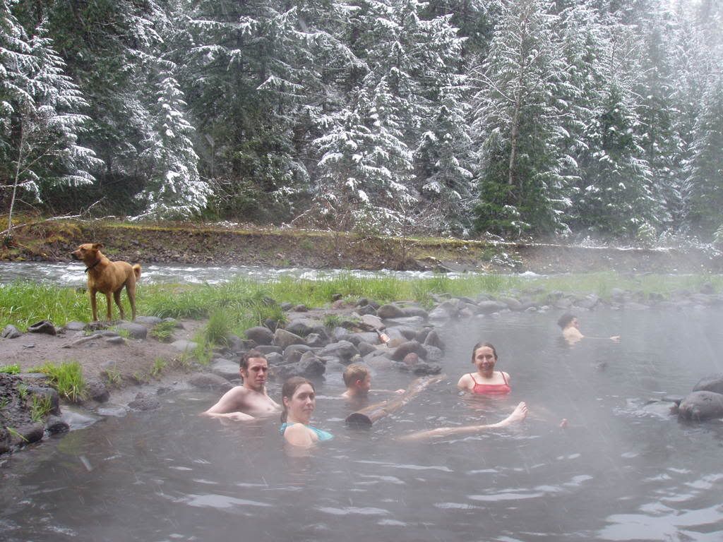
WHEN THE WEATHER HEATS UP...IT MAY BE TEMPTING TO JUMP INTO AREA
LAKES AND RIVERS...SOME OF WHICH WILL HAVE SLIGHTLY ELEVATED
LEVELS DUE TO SNOWMELT BROUGHT ON BY THE HOT WEATHER. KEEP IN MIND
THAT MOST LAKE WATER TEMPERATURES ARE STILL IN THE 40S AFTER THE
COOL SPRING WEATHER. RIVERS FED WITH SNOWMELT COULD EASILY HAVE
WATER TEMPERATURES IN THE 30S. DURING SPRING HEAT WAVES OF THIS
MAGNITUDE...IT CAN BE AN IRONIC TWIST OF FATE FOR PEOPLE TO
ESCAPE THE HEAT BY JUMPING INTO RIVER AND LAKES...ONLY TO SUFFER
OR EVEN DIE FROM THE HYPOTHERMIA BROUGHT ON BY THE FRIGID WATER
TEMPERATURES. DESPITE THE HOT WEATHER...PEOPLE SHOULD STILL USE
COLD WATER SAFETY PRACTICES BY WEARING A WETSUIT WHEN GOING INTO
SUCH COLD WATERS.

LASTLY...WITH PLENTY OF SNOW STILL LEFT IN THE MOUNTAINS...THE
RECENT RAIN AND THE UPCOMING HOT SPELL WILL PROVIDE SUBSTANTIALLY
HIGHER AVALANCHE DANGER. PLEASE REFER TO LATEST FORECASTS AND
STATEMENTS FROM THE NORTHWEST WEATHER AND AVALANCHE CENTER AT
WWW.NWAC.US.

--------------------------------------------------------------------------------

SPECIAL WEATHER STATEMENT
NATIONAL WEATHER SERVICE PENDLETON OR
453 AM PDT WED MAY 14 2008

ORZ041>044-049-050-501>506-WAZ024-026>030-501-502-150000-
EASTERN COLUMBIA RIVER GORGE OF OREGON-NORTH CENTRAL OREGON-
CENTRAL OREGON-LOWER COLUMBIA BASIN OF OREGON-GRANDE RONDE VALLEY-
WALLOWA COUNTY-FOOTHILLS OF THE BLUE MOUNTAINS OF OREGON-
NORTHERN BLUE MOUNTAINS OF OREGON-
SOUTHERN BLUE MOUNTAINS OF OREGON-
NORTHERN WHEELER AND SOUTHERN GILLIAM COUNTIES-JOHN DAY BASIN-
OCHOCO-JOHN DAY HIGHLANDS-
EASTERN COLUMBIA RIVER GORGE OF WASHINGTON-KITTITAS VALLEY-
YAKIMA VALLEY-LOWER COLUMBIA BASIN OF WASHINGTON-
FOOTHILLS OF THE BLUE MOUNTAINS OF WASHINGTON-
NORTHWEST BLUE MOUNTAINS-
EAST SLOPES OF THE CENTRAL CASCADES OF WASHINGTON-
EAST SLOPES OF THE SOUTHERN CASCADES OF WASHINGTON-
INCLUDING THE CITIES OF...THE DALLES...DUFUR...MADRAS...MAUPIN...
MORO...BEND...LA PINE...PRINEVILLE...REDMOND...ARLINGTON...
BOARDMAN...HERMISTON...LA GRANDE...ELGIN...UNION...ENTERPRISE...
JOSEPH...WALLOWA...HEPPNER...PENDLETON...MEACHAM...TOLLGATE...
UKIAH...CONDON...FOSSIL...SPRAY...JOHN DAY...MONUMENT...
DAYVILLE...LONG CREEK...MITCHELL...SENECA...WHITE SALMON...
ELLENSBURG...SUNNYSIDE...YAKIMA...CONNELL...PROSSER...
TRI-CITIES...DAYTON...WAITSBURG...WALLA WALLA...CLE ELUM...
EASTON...ROSLYN...NACHES...GOLDENDALE...APPLETON...TROUT LAKE...
BICKLETON
453 AM PDT WED MAY 14 2008

...UNSEASONABLE HOT TEMPERATURES EXPECTED FOR THE REGION STARTING
THURSDAY...

A RIDGE OF HIGH PRESSURE WILL BEGIN TO BUILD OVER THE PACIFIC
NORTHWEST TODAY AND FURTHER INTENSIFY OVER THE REGION THURSDAY
THROUGH SATURDAY AS THE CENTER OF THE HIGH MOVES OVER OREGON.
AFTERNOON TEMPERATURES WILL SOAR TO WELL ABOVE NORMAL WITH NEAR
RECORD HIGHS EXPECTED THURSDAY THROUGH SATURDAY.

THE HOT WEATHER WILL BE SHORT-LIVED AS A WEATHER SYSTEM IS
EXPECTED TO MOVE INTO THE NORTHWEST ON SUNDAY WITH COOLER
TEMPERATURES.

THE HOT WEATHER WILL ALSO INCREASE SNOW MELT RUNOFF WITH
SIGNIFICANT RISES EXPECTED ON AREA RIVERS THROUGH THE WEEKEND. THE
RIVERS MOST LIKELY TO BE AFFECTED ARE THE NACHES AND YAKIMA RIVERS
IN CENTRAL WASHINGTON AND THE GRANDE RONDE RIVER IN NORTHEAST
OREGON. THESE RIVERS ARE NOT EXPECTED TO REACH FLOOD STAGE...BUT
SHOULD SEE THEIR HIGHEST WATER LEVELS THUS FAR THIS SPRING.
http://greencascadia.blogspot.com
http://pdxvolksfolks.blogspot.com
it balances on your head just like a mattress balances on a bottle of wine
your brand new leopard skin pillbox hat

Post Reply